Formed in 2008, the University of Louisville's City Solutions Center was a partnership with the Kentucky League of Cities. Working together with KLC, the City Solutions Center extended the University of Louisville's urban mission across Kentucky by providing hands-on consulting to help communities engage citizens to define challenges, develop buy-in for solutions, and create implementation plans. The Center drew upon existing faculty, staff, and student expertise throughout the University of Louisville to provide resources to assist Kentucky's communities.
The City Solutions Center was housed at the Urban Design Studio and shared staff and other resources until it was dissolved in 2011. The following reports were created by the City Solutions Center between 2008-2011.
 |
Kentucky Wet Growth HandbookThe handbook has been created to help familiarize the reader with the concept of wet growth and tools for dealing with wet growth in community settings. It is a summary of Kentucky Wet Growth Tools for Sustainable Development" A Handbook on Land Use and Water for Kentucky Communities, written by Craig Anthony Arnold, Carol Norton, and Dustin Wallen, of the University of Louisville Center for Land Use and Environmental Responsibility. |
 |
Urban Agriculture and the Parklands of Floyds ForkThis report identifies best practices and provides recommendations on how to incorporate urban agriculture sites into the Parklands of Floyds Fork. The primary focus of the report is on community gardens and small-scale agricultural sites. The report addresses forms of agriculture that are community-accessible, such as demonstration gardens, orchards, or heritage farms, and provides recommendations on developing and sustaining agricultural sites within the park. |
 |
Cane Run Elementary Schoolyard ProjectThe purpose of the Cane Run Elementary Schoolyard Project, as with that of Portland Elementary, is to redefine both the appearance and use the school's outdoor space. Redevelopment of the school's grounds provides new resources and opportunities for teachers to engage their students in the school's environmental education curriculum by invigorating students' interest in learning not only about the environment but about many other facets of the curriculum. Additionally, the study examines the school's connection to the surrounding neighborhood in an attempt to reconnect the school with the local community. |
 |
Portland Elementary Schoolyard ProjectThe purpose of the Portland Elementary Schoolyard Project is to redefine both the appearance and use of the school's outdoor space. Redevelopment of the school's grounds provides new resources and opportunities for teachers to engage their students in the school's environmental education curriculum by invigorating students' interest in learning not only about the environment but about many other facets of the curriculum. Additionally, the study examines the school's connection to the surrounding neighborhood in an attempt to reconnect the school with the Portland community. |
 |
Schoolyards as Resources for Learning and Communities: A Handbook for Kentucky SchoolsBuilding on the work done by City Solutions Center on Portland and Cane Run Elementary Schools as well as insight and information gathered from research and site visits of other programs around the country, including the Boston Schoolyards Initiative, this handbook of best practices aids schools and school districts in deciding how they can improve their schoolyards and help create outdoor learning spaces that can improve the educational experience they provide. |
 |
Kentucky's City Classification SystemThis report looks at Kentucky's city classification system, what it means, and the implications on a significant number of cities that are currently misclassified under the system. |
 |
Health Impact Assessment: An Introduction and guide for implementation in LouisvilleThe purpose of this report is to inform the ongoing discussion about Health Impact Assessment (HIA) in Louisville, Kentucky. Although there are many questions to consider regarding HIA, this report focuses on: defining HIA and identifying the values associated with it; HIA's purpose and goals, which include public health benefits; the range in types of HIA; and the general procedural framework for conducting an HIA. This report also provides examples of HIA checklists, which are used as preliminary devices to facilitate discussion on plans, programs, policies, or projects that may have an impact on health in the built environment. It also provides examples of each of these four types of HIAs. |
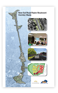 |
New Cut Road Corridor StudyThis project aims to develop a plan for the New Cut Road/Taylor Boulevard Corridor extending from the Watterson Expressway south to the Gene Snyder Expressway in Louisville, Kentucky. The intention is to develop a community-based vision for the corridor that will ensure that it is an asset for the surrounding neighborhoods rather than a negative influence. The Corridor is the gateway from the Watterson Expressway to adjacent neighborhoods and to significant recreational, arts, and equine activities, including Iroquois Park and Amphitheater, Jefferson Memorial Forest, and Fairdale Village (subject of a recent neighborhood plan). Possible benefits of an improved Corridor include: better promotion of area attractions; better opportunities for small businesses; stimulation of the area housing market; and a more attractive and functional "Main Street" for local neighborhoods. |
 |
Shelbyville 7th Street Corridor PlanThe 7th Street Corridor Plan was developed by the City Solutions Center in cooperation with the Triple S Planning Commission in Shelby County, Kentucky. The purpose of the project was to develop a plan for the 7th Street corridor in Shelbyville, Kentucky, between downtown Shelbyville and Clear Creek Park. The project aimed to develop a community-based vision for the corridor to ensure that it is an attractive and functional connector between downtown and the park entrance. The primary focus was on land use, streetscape, and infrastructure, including traffic flow. The planning process involved a series of public meetings to assess the study area and develop a vision for the future of the corridor based on community input and feedback. |
 |
Bashford Manor Corridor Streetscape StudyThe City Solutions Center worked with the Center For Neighborhoods to develop a streetscape improvement plan for the section of Bardstown Road from the Gardiner Lane Shopping Center south to Hikes Lane in Louisville, Kentucky. The current corridor consists of predominantly commercial establishments that have little relationship to the street resulting in poor connectivity and cohesion. The study looks at ways to improve connectivity for all modes of transportation and address the issue of a lack of sense of place through public meetings and design development. |
 |
Jeffersonville Neighborhood Leadership Institute Fall 2010The Jeffersonville Neighborhood Leadership Institute (JNLI) engaged 34 citizens of Jeffersonville, Indiana in a process of learning about, and improving their communities. The 11-week program included an array of topics and speakers, ranging from public art to public governance, and provided guidance on tasks such as obtaining 501(c)(3) status for a neighborhood organization and how to apply for grants for neighborhood improvement projects. The JNLI process was facilitated by the City Solutions Center. |
 |
Responding to Housing Foreclosures and Vacancies: A Handbook for Small Cities in KentuckyThis handbook is intended to help smaller cities respond to the problems caused by rising foreclosures, vacancies, and distressed housing. It is intended to suggest some practical steps that cities can take to evaluate and respond to their particular circumstances. The handbook emphasizes understanding the particular context and circumstances in each city and choosing appropriate responses. |
 |
A Strategy for Greensburg's Vacant and Distressed HousingThis report presents a strategy for reducing the negative impacts of housing foreclosure, vacancy, and disrepair in Greensburg, Kentucky. Greensburg is a small city that is somewhat removed from Kentucky's main urban centers and transportation routes. Its location has not, however, insulated it from the national foreclosure crisis. Although the City's absolute numbers of foreclosures are small, they have been rising over the past several years to the point where they represent a significant problem in percentage terms. Combined with a weak economy, the high foreclosure rate aggravates problems of housing vacancy and disrepair. |



 View photostream on flickr