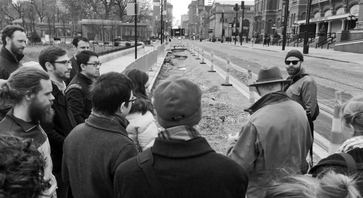
The Capstone Studio projects are developed by the students and faculty of the University of Louisville's Master of Urban Planning (MUP) program. The projects cover a wide range of topics and locations and involve the students working in teams to address real planning problems under the guidance of faculty members. The Capstone Studio is a required course for students in the MUP program. Its central purpose is to give students the opportunity to integrate what they have learned during their studies while solving real world urban planning issues.
 |
2011: The LIFE ZoneThe capstone studio studied the feasibility of establishing a Locally Integrated Food Economy Zone (LIFE Zone) to create a vibrant, local food economy by establishing a hub where food growers, producers, and processors collaborate and share resources to maximize benefits. By eliminating barriers and providing incentives, the goal of the LIFE Zone would be to create jobs in an array of businesses related to local food. The LIFE Zone's ancillary benefits would include community development, public health improvement, brownfield remediation, improved environmental sustainability, elevated food security and greater social equity. This study builds upon dozens of previous efforts to establish a locally integrated food economy and positions the city to achieve this goal. Through complex data analysis coupled with stakeholder input The Capstone Studio determined the LIFE Zone's best location to be bounded by Interstate 64 on the north, West Jefferson Street on the south, Ninth Street on the east, and Nineteenth Street on the West. The Capstone Studio aslo determined that a Planned Development District would provide the most flexible zoning to eliminate barriers and stimulate activity in the LIFE Zone. |
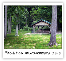 |
2010: Facilities Improvement Strategic Plan for Floyd CountyNew Albany – Floyd County Parks and Recreation Department decided to reevalute a number of aspects addressed in the 2008 Master Plan for its parks. The 2010 Capstone helped with this initiative by focusing on collecting data and information regarding both public and private recreation lands and facilities as well as the creation of a strategic plan that studied underserved ares and a park improvement matric that focused on areas of possible expansion or improvement. The project was a collaboration between the Master of Urban Planning students at the University of Louisville and the University of Kentucky students in landscape architecture. The study provided strategic planning tools and provided two recommended scenarios to increase their existing park system by 80 acres to align with national guidelines for the appropriate amount of park and greenspace per capita. |
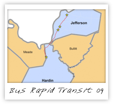 |
2009: Sustainable Transportation through Bus Rapid TransitThree students from the 2009 Capstone explored the possibility of developing a sustainable transportation option to Dixie Highway, one of Louisville's main southwest corridors through the implementation of bus rapid transit (BRT). The purpose of the study was to determine the level of sustainbility of the Louisville Metro transportation network and the feasibility of bus rapid transit on US 31, better known as Dixie Highway. Due to the projected expansion of Fort Knox in Hardin County south of Metro Louisville, US 31 could serve as the main connection between the growing military base, towns just south of the base, and Metro Louisville. The group looked at different models of existing BRT and made several recommendations on how BRT could be implemented in the corridor including where four major stops would most likely be most effective. |
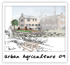 |
2009: Urban AgricultureConsideration of what constitutes a sustainable food system and its implications are critical in the face of global climate change, food safety and equitable food access. The study prescribes a plan for a sustainable model of local food cultivation in Jefferson County, Kentucky. The study moves from an expository of national Best Practices to a site-specific description of the process of growing vegetables, creating community and developing economic opportunities. The case study further explores the interaction between Washington Park, Rutherford Elementary School and the adjacent retail outlets. Washington Park is a forward thought development that enhances the chain of food security not only in Louisville but in the region and with this model case study one would hope for more forward thinkers to follow this to create a more sustainable and more secure food environment. This model details how an apartment community occupied with monthly leased tenants can offer them the opportunity of building community along with economic opportunities through the sale of produce grown on site. |
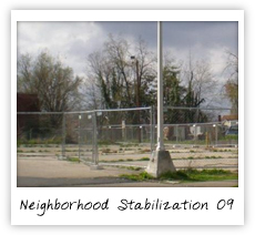 |
2009: Neighborhood StabilizationWith the recent housing bust and associated increase in foreclosure rates, the degradation of urban neighborhoods is increasing dramatically. This project explored best practices for reclaiming and revitalizing vacant property in sustainable ways in order to stabilize these ailing neighborhoods. The study also explored ways to invigorate neighborhoods utilizing beautification techniques as well as introducting "green" technologies to improve the quality of life of those who visit and reside in distressed neighborhoods. |
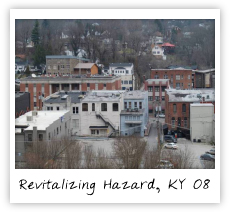 |
2008: Revitalizing Downtown Hazard, KentuckyOne group of the 2008 Capstone Studio looked at ways to revitalize downtown Hazard, Kentucky. Through focus groups, surveys, and identification of problems and opportunities led to the concentration of goals centered on downtown Hazard. Four goals and objectives were established through the study including the creation of jobs downtown, create more places for people downtown, downtown beautification, and utilizing existing assets. Some details of the plan include looking at creating 2 miles of trails that would serve as a riverwalk and connector, targeting vacant and dilapidated buildings, strategically incorporate parks and greenspace, development of a gateway to Hazard, and implement downtown office development strategy, among others. The group also explored the funding mechanisms and existing resources available to reach the goals and objectives. |
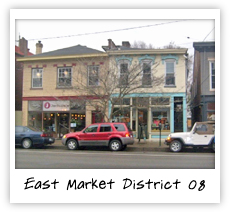 |
2008: East Market DistrictThe East Market District is situated immediately west of downton along Market Street. Known for its monthly gallery hop, the district is comprised of a variety of art galleries and diverse businesses that draw Louisvillians to the area. One group from the 2008 Capstone Studio was tasked with creating a plan for the East Downtown Business Association on how to better strengthen the district's image as a clean, safe, walkable, and accessible place to visit. The group conducted a pedestrian survey and inventoried areas in need of improvement. These identified problems informed the following process of developing recommendations that would further the goals of the East Downtown Business Association. Recommendations were provided that identified specific areas to implement traffic calming measures, build connections with adjacent communities, and add public art and landscaping to the area, to name a few. As a result, the client was provided with a written plan document to reference when making improvements to the East Market District. |
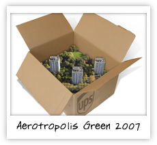 |
2007: AerotropolisLocated just beyond the southeast corner of Louisville's central business district, is a distressed area that serves as a physical, social, and psychological barrier between East and West Louisville known as the Park Hill Corridor. A laundry list of ills stricken the corridor including: brownfields both real and perceived, an abundance of vacant and abandon lots, a small and fragmented population, pockets of extreme poverty, and high levels of unemployment. The transportation infrastructure throughout the study area lacks coherence. Many of the roadways have been severed from surrounding neighborhoods by industrial properties, blocked streets, or a maze of railroad tracks. Through all of the issues within the Park Hill Corridor, there remains a unique and exciting opportunity to take a comprehensive look at the area, rediscover the hidden connections and rich past, to explore the very real possibilities of reshaping and restoring the lost fabric of an area in the heart of Louisville. The study offers the grounds for a proposal that will reshape the entire metropolitan region, centered on the Park Hill Corridor and the Louisville International Airport. Utilizing a growing development centered around transit oriented design, specifically around Just in Time delivery service, with the UPS Worldhub at the center. |
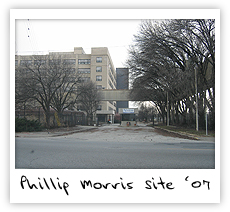 |
2007: Development Plan for Phillip Morris SiteLocated at the north end of the Park Hill Corridor, the Philip Morris site lies on one of the few east-west thoroughfares in the area. With the Park Hill Corridor to the south and the west end of Louisville to its west, the Philip Morris site provides an opportunity to spur economic development in the deteriorated industrial sites of the Park Hill Corridor study area and provide a boost to the neighborhoods of the west end. This project provides a plan for redevelopment of the Philip Morris site that sits at the fulcrum of the vision of the Park Hill Corridor Group, the Louisville Metro Government and sound planning principles. The site includes two existing buildings, one of which dates back to the early twentieth century and was used primarily for tobacco manufacturing and offices. The other, more modern building is a more typical one-story warehouse structure. Both sit vacant, ripe with opportunity. |
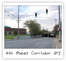 |
2007: South Central Fourth Street Corridor PlanThis planning study was created to explore the possibility of connecting two important economic generators adjacent to the Park Hill Corridor. These generators are the University of Louisville and Churchill Downs. This study examined how existing neighborhood conditions can be enhanced and how the transportation system of the area can be manipulated to create a vibrant and walkable commercial district. This commercial district would provide goods and services to University students and sports fans, Churchill Downs patrons, tourists and adjacent neighborhood residents. This walkable district will promote the Park Hill Corridor as an active living community that embraces healthy lifestyles. By rehabilitating this corridor, a great sense of place will be created and the image of Park Hill will be enhanced. Tourists, investors, students and Louisville residents will be drawn into the area, which is critical to the rehabilitation of the entire Park Hill Corridor. |
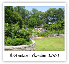 |
2007: Louisville Botanical GardenThis project proposes the transformation of an underutilized industrial brownfield into a community-oriented, multi-use development that is anchored by a world-class botanical garden. The project attempts to address many of the issues confronting the Park Hill Corridor including brownfield contamination as well as opportunities for re-use of vacant industrial buildings. The group looked at the possible development of an attraction that would bring together all people from the Greater Louisville Metro area with a strategy that could act as a catalyst for economic revitalization within the Park Hill Corridor. |
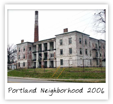 |
2006: Portland NeighborhoodLouisville Metro Mayor Jerry Abramson has earmarked $2 million of combined Community Development Block Grant (CDBG) and HOME program funds for housing improvements in the Portland neighborhood. The Project Team's mission was to offer a proposal for the distribution of these funds in accordance with the Mayor's goals and the needs of Portland residents. In order to determine the needs of the community, the Project Team conducted a preliminary assessment of the entire Portland neighborhood. In addition, the Project Team met with stakeholder groups including the Portland Neighborhood Plan Task Force, Portland Now, and the Louisville Metro Department of Housing. Armed with this information, a proposal was formulated for the use of the funds. The resulting plan can serve as a template for further study of identified areas in the neighborhood. |
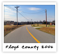 |
2006: Floyd CountyCentral Floyd County, Indiana is experiencing significant new development as more and more people discover residential opportunities in the scenic, rural atmosphere of the knobs. Convenient access to employment centers in the nearby cities of New Albany, IN and Louisville, KY makes the area particularly attractive for development. In anticipation of future growth, the Floyd County Comprehensive Land Use Plan Update, "Cornerstone 2005", designates two unincorporated areas of (1) the Highlander Point/US 150 corridor and (2) the State Road 64/62 corridor as Gateway Overlay Districts. By establishing Gateway Overlay Districts, the community can develop a series of standards to ensure quality development along these corridors. Throughout the spring of 2006 the University of Louisville's Master of Urban Planning Capstone analyzed the Highlander Point Gateway District at the convergence of Interstate 64 and US Highway 150. Their goal was to determine urban planning principles and design components to be used in guiding the growth of this rapidly developing district. The students worked closely with local planning staff and citizens to identify strategies to ensure the fulfillment of the community's vision. |
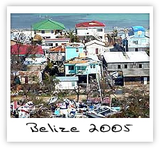 |
2005: Planning for Natural Hazards in the CaribbeanThe spring 2005 Capstone Studio's assignment was developed in response to a request that the MUP program participate in the University of Louisville's International Service Learning Program (ISLP) in Belize. The project involved the carrying out of preliminary research in Belize in support of a larger Caribbean-wide hazards mitigation project to be undertaken by the University of Louisville's Center for Hazards Research and Policy Development in collaboration with the Caribbean Community Climate Change Centre in Belize. The Center for Hazards Research and Policy Development's project is designed to create a model of vulnerability and risk assessment that can be implemented in all countries within the Caribbean region. It is anticipated to: 1) collaboratively create a vulnerability and risk assessment model that can be applied initially in a test-bed scenario in Belize (applied to Belize City and/or nationwide) |
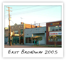 |
2005: East Broadway CorridorThe University of Louisville's Capstone Studio, in partnership with the Urban Design Studio, worked with local neighborhood leaders and active members of the East Broadway neighborhood to create a vision for the future of East Broadway. The Capstone recommends a new economic vision for the East Broadway Corridor. This economic vision should focus on private development along and around the corridor; it should also spur public involvement and investment. This vision should include economic incentives and aesthetic enhancements and new ideas in the use of human and financial capital. The Capstone suggests the creation of a Business Investment District (BID) as a way of achieving these goals. The BID should encapsulate the entire East Broadway corridor. It should consist of a formal organization (created by Louisville Metro) run by the private sector and funded by private investment. The BID could levy fees on new and existing businesses and encourage investment using public and private input. Local residential areas and businesses should be encouraged to participate fully in the planning process to make the most of the BID. |
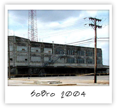 |
2004: The Revitalization of South BroadwayThe location of South Broadway (SoBro), between Louisville's central business district and the area including historic Old Louisville and the University of Louisville presents a unique opportunity for the neighborhood to act as a connector to these diverse communities. Because the area has suffered from economic decline over the past century, this interconnection could serve to revitalize this once thriving community. The area is currently filled with vacant lots; serving as reminders of their previous use, car lots (some abandoned and some still in use) and surface parking which bustled during the automobile boom of the 1950s. Second to paved parking lots, there is a concentration of varied institutional uses ranging from social service centers to a small private university. The challenge is to find the means to harness these urban amenities while creating a smooth transition between SoBro and its surrounding communities. The report produced by the 2003 Planning Capstone followed a planning process beginning with an overall site analysis that focused on the regulatory, physical, historical, and demographic environments. The next phase in the planning process was a forum between planners and stakeholders with the purpose of presenting the revised list of strengths and weaknesses and identifying goals and objectives. The outcome of this forum was a list of goals and objectives that reflected the planning team's site analysis and stakeholders' priorities. These were then incorporated into the planning process and synthesized into a list of recommendations intended to accomplish the previously determined objectives. This project was suggested by staff of the Louisville Metro Department of Planning and Design Services in anticipation of formal establishment of a neighborhood planning task force for SoBro. All of the data collected by the Capstone Studio planning team were provided to Louisville Metro Planning and Design Services to help inform the official planning process |
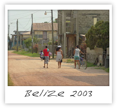 |
2003: Dangriga, BelizeThis project originated in response to a request to participate in the University of Louisville's International Service Learning Program (ISLP) in Belize. The ISLP has participated in service-learning projects in Belize for the past six years, aimed at aiding native Belizean while educating University students in a mutual exchange of intellectual and human capital. The main trust of these ventures has been in the two towns of Dangriga and Gales Point, both in the Stann Creek District south of Belize City. The University of Louisville's Master of Urban Planning Program first became involved in this project on an introductory fact-finding trip made during the spring of 2003. During this trip the Mayor of Dangriga invited University of Louisville urban planners to prepare a feasibility study for undertaking a town plan for his town. Forming a comprehensive plan for the town was on a list of four community goals and objectives for which the mayor's political party, the Peoples United Party (PUP), campaigned. The mayor also indicated five substantive issues that he felt were the most important to the Dangriga community: water quality, sewage and waste disposal; urban renewal; growth management; hurricane management and disaster mitigation; eco tourism and tourism development. This task was given to students of Urban Planning Capstone Studio, a required course for planning students at the University of Louisville, giving them the opportunity to integrate principles learned in class with a real planning project. The students undertook a semester-long study of Belize and city planning within the developing world. This involved intensive data collection, analysis, class and team meetings, preparation of oral and written reports, and graphics |


 View photostream on flickr